Stay in the know about our latest features and capabilities, important changes, new tools, and more.
A tool to fix common KML file issues
We built a tool to automate the repair of common KML file issues that block job processing and parsing by GIS applications. This can help our partners leverage problematic files handed off from downstream firms without the need to manually re-trace the project boundaries.
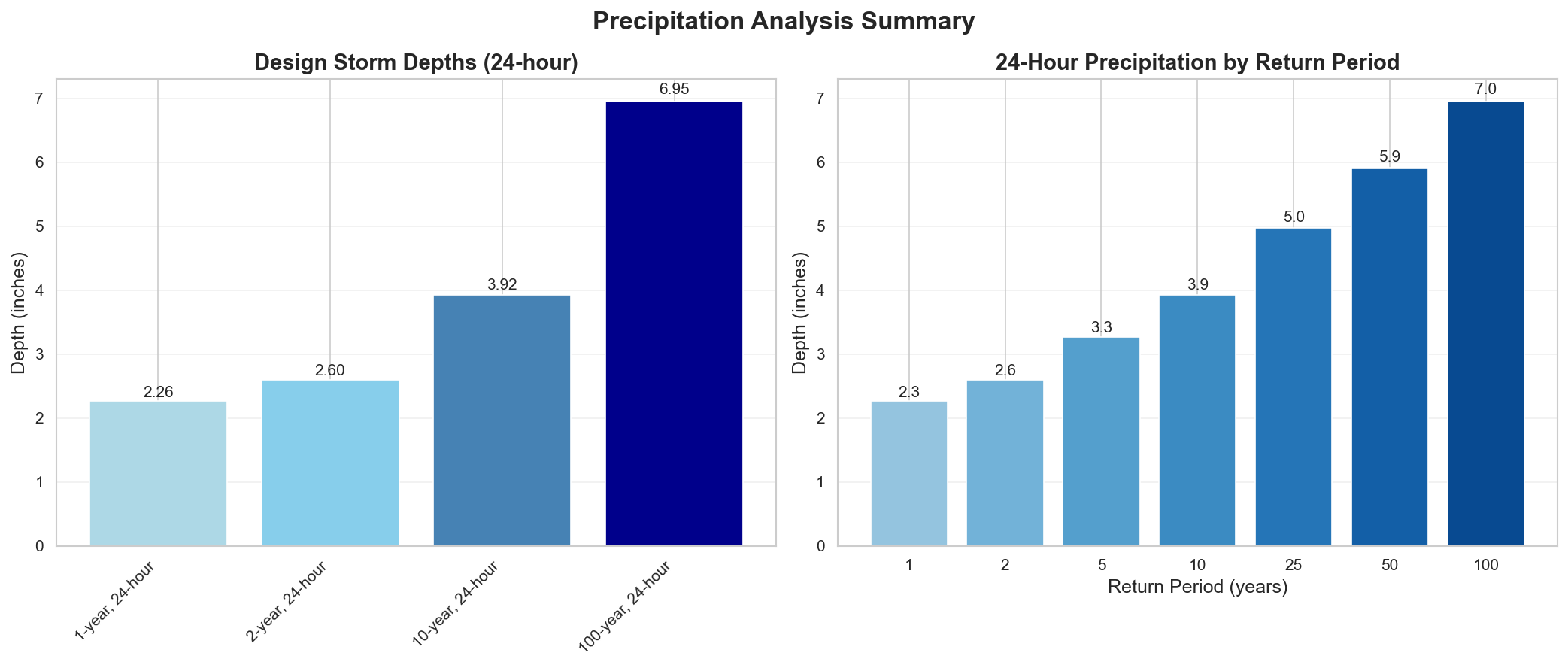
Hydrological insights — in minutes
Our Hydrological Requirements Reports leverage AI to research and summarize site-specific flood, precipitation, and permitting insights in a fraction of the time required for manual research.
Dedicated cloud environments for your jobs
Scalable cloud environments with partner-committed resources can substantially improve processing speed and throughput for partners with high-volume, high-iteration workflows.
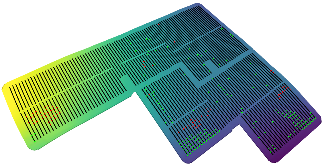
Interactive 3D Plots
3D web-based renderings give partners a clearer view of Solar Layout Analysis results, displaying slope, elevation, grading adjustments, and row alignment in detail. These interactive maps help engineering teams spot issues early and validate design decisions more efficiently than with raw data or static plots.