Hydrological insights — in minutes
Hydrological evaluation is often where solar project planning slows down. Each site must be reviewed against federal, state, and local requirements, and the research burden typically falls on engineering teams who are already at capacity with solar layout design and analysis. Even after hours spent reviewing FEMA maps, NOAA precipitation data, and permitting documents, critical details can still slip through the cracks — creating costly surprises later.
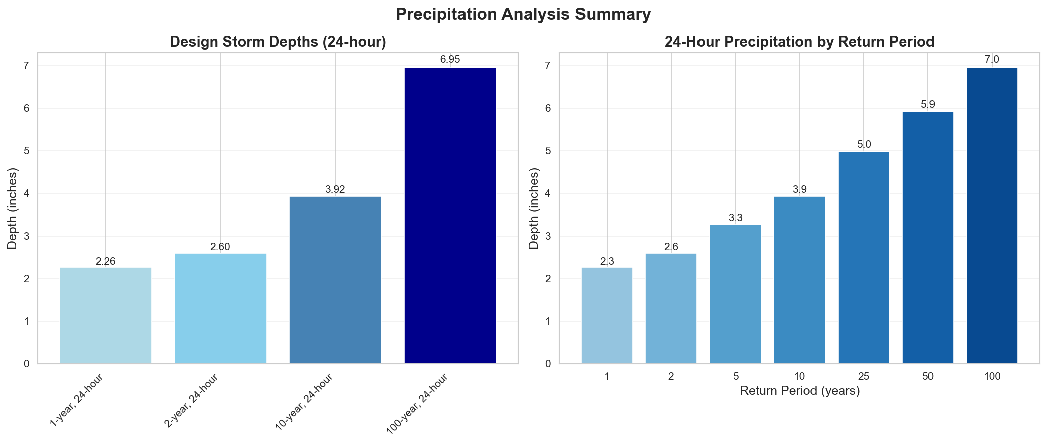
ORCaS Hydrological Requirements Reports substantially reduce project uncertainty. With a simple request, our system compiles and interprets site-specific data from trusted sources including USGS, NOAA Atlas 14, and FEMA NFHL. In less than 15 minutes, you receive a report that highlights flood zones, precipitation patterns, and regulatory considerations unique to your project location. Here are a few examples, for sample sites located in areas of intensive solar development:
- Kern County, California
- Maricopa County, Arizona
- Nye County, Nevada
- Millard County, Utah
- Mississippi County, Arkansas
- Wharton County, Texas
As the examples illustrate, these hydrological reports go far beyond presentation of raw datasets: they chart rainfall patterns, surface regional requirements, provide local authority contacts, and recommend next steps — giving project leaders confidence that they are acting on comprehensive information from the start. For engineering teams, it means less time hunting down data and more time applying judgment. For stakeholders, it means faster validation of site feasibility and fewer surprises downstream.
Reports can be requested directly via our web form, and every Solar Feasibility Forecast automatically includes one. Whether you’re deciding whether to pursue a site, preparing a feasibility analysis, or scoping further hydrological studies, ORCaS Hydrological Requirements Reports provide a reliable foundation for better, faster decisions.